As the importance of addressing pressing environmental issues such as climate change and air quality grows ever more critical, so has the need for better tools and data sources to effectively tackle these challenges. To aid in these efforts, the Google Maps Platform has recently released a new Environment suite of APIs for Solar, Air Quality, and Pollen. These APIs enable developers to incorporate better data into their applications that provide actionable insights for improved health and sustainability decision making.
The Solar API

Renewable energy sources reduce the amount of greenhouse gasses emitted into the atmosphere and can greatly improve energy security and independence. With the deployment costs of solar systems dropping, adding rooftop solar to a home can also be an effective way for homeowners to reduce their energy costs while simultaneously lowering their carbon footprint.
The Solar API is intended to help accelerate the adoption of solar systems by providing homeowners with the information they need to make informed decisions about solar installation. The API contains two primary components: Building Insights and Data Layers. Building Insights provides critical data regarding a rooftops potential for solar such as the amount of sunlight it receives and an optimized solar panel arrangement. Data Layers provide detailed information on factors that influence the design and performance of solar systems such as rooftop shading as well as a Digital Surface Model (DSM) of the rooftop.
The Air Quality API
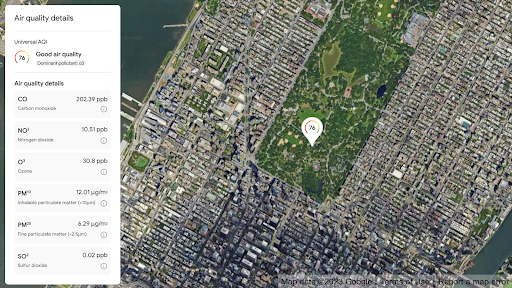
Air pollution is one of the greatest environmental risks to health, according to the World Health Organization, and results in millions of premature deaths globally every year as well as damaging effects to economies. The Air Quality API provides detailed and reliable information about air quality for a location including the current concentrations for a host of pollutants and enables the visualization of pollutant levels through heatmaps.
The API combines terabytes of data every hour from a variety of sources including government monitoring stations, low-cost sensors, meteorological data, satellites, land cover, and live traffic information in order to account for the dynamic nature of air quality and provide reliable information that is specific to an area. This enables individuals to make hyperlocal health-related decisions to minimize their exposure to air pollutants such as whether to walk or drive to a location, when to exercise outside, which park to go to, and other preventative measures that vulnerable groups can take to manage their risk and symptoms.
The Pollen API
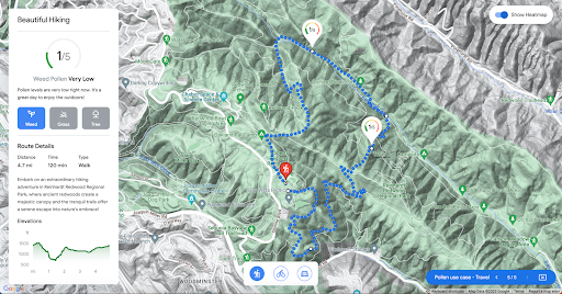
According to the World Allergy Organization, over 400 million people experience pollen-related allergies globally, and the issue is anticipated to grow as the length and severity of pollen seasons increase due to rising temperatures brought on by climate change. The Pollen API can help allergy sufferers limit exposure to allergenic pollen and make better informed decisions to manage their symptoms.
Many allergy medications are most effective when they are taken before the onset of symptoms, but pollen reporting has traditionally been a very manual and time-consuming process that often provides delayed results. By providing current and forecasted pollen levels that are specific to certain plants at high spatial resolution, the Pollen API enables individuals to take a more proactive approach which can significantly enhance allergy symptom management. It was designed to support a number of health-related use cases by providing localized pollen count data, visualizations of current and forecasted pollen levels, detailed plant allergen information, and tips to minimize pollen exposure.
Contact us to discuss how you can leverage the Environment APIs in your own solutions!
